K2 Gondogoro La Trek
Request a quoteExplore
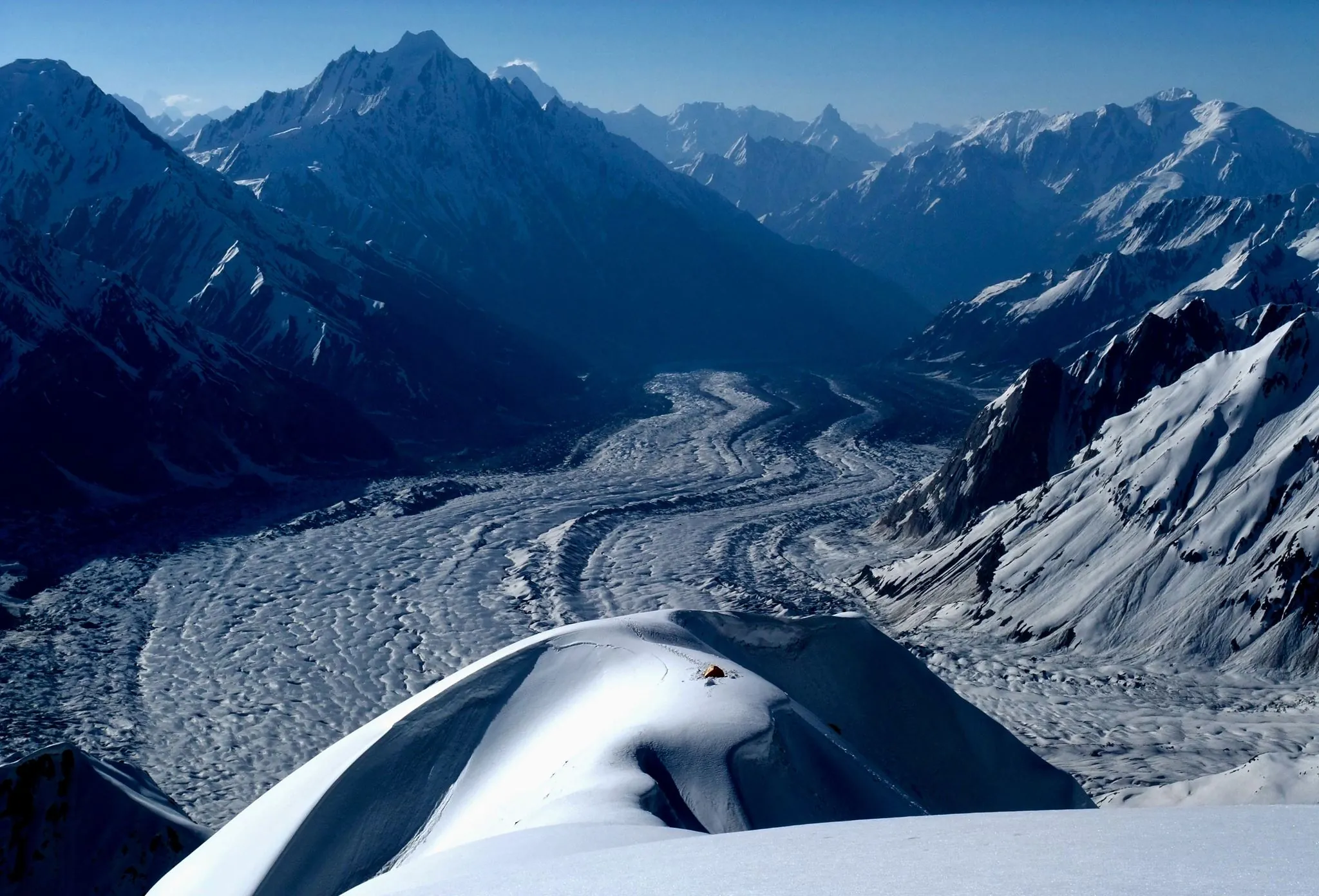
A 14-day traverse of Nanga Parbat from the Rupal Face to the Diamir side over the Mazeno La, at about 5,399 m. A strenuous, committing crossing for experienced trekkers.
Per person in USD, full-board — the larger your group, the lower the per-person cost. We confirm your exact all-in figure in writing before any deposit.
| Group size | Per person |
|---|---|
| 7–10 people | $2,200 |
| 4–6 people | $2,600 |
| 1–3 people | $3,200 |
Excludes international flights, Pakistan visa, insurance, personal equipment and tips.
Guaranteed small-group dates for the 2027 season. Prefer your own dates? Every trip can also run privately inside its season window.
| 5 Jul 2027 → 18 Jul 2027 | Book this date |
|---|---|
| 20 Jul 2027 → 2 Aug 2027 | Book this date |
| 5 Aug 2027 → 18 Aug 2027 | Book this date |
This is a 14-day traverse of Nanga Parbat (8,126 m), from the Rupal valley on the south side to the Diamir side on the west, by way of the Mazeno La at about 5,399 m. It begins beneath the Rupal Face, which rises roughly 4,600 m from the valley floor and is generally counted the highest mountain face in the world, and ends below the Diamir Face. It is a serious, committing crossing for experienced trekkers: long days, camping throughout, a glacier approach and a pass that cannot be turned back from easily once the group is high on it.
From Islamabad we drive up the Karakoram Highway to Chilas, then on through Astore to Tarashing, the last village of the Rupal valley, at about 2,900 m. The path up the valley leads to the Herrligkoffer Base Camp, named after Karl Herrligkoffer, who organised several German-Austrian expeditions to the mountain, at about 3,600 m. From there the whole width of the Rupal Face stands overhead, and it was on this face that Reinhold and Günther Messner climbed in 1970. We then spend a day resting at base camp before turning towards the Latabo and Tap meadows and the approach to the Mazeno side.
The Mazeno La is a high saddle on the Mazeno Ridge, the long, jagged crest that runs west from the summit of Nanga Parbat. The route climbs to it over moraine and glacier, with a camp below the pass, and the crossing itself is a long day on the glacier, over the pass and down the far side. The crossing is mostly walking rather than technical climbing, but it involves glacier travel and snow or loose rock on the approach and descent; we use rope, harnesses, crampons and an ice axe where our guides judge them necessary. The height of the pass and the snow conditions on the day decide how it goes, and the schedule has a reserve day for weather.
On the far side the route descends to the Diamir valley, with the Diamir Face above, and walks out to a roadhead and the Karakoram Highway at Chilas. This side of the mountain is less visited, and the paths and camps are simpler. We have not described every campsite by name, because the exact camps, and sometimes the exit road, depend on the season's snow and on the arrangements in force on the Diamir side; your guide confirms them before the trek begins.
Camps are tented, with a cook and kitchen crew and porters carrying the camp equipment and food while you carry a day pack. There is no road, shop or phone signal on most of the trek, and a rescue from high on the route would take time. Because of that, the trek suits people who have already walked for several days above 4,000 m and are comfortable on a glacier; it is not a first high-altitude trek. We grade it Strenuous: the individual stages are not technical, but the cumulative altitude, the length of the days, the cold at the high camp and the committing nature of the pass make it one of the harder walks we run.
We ask for previous experience of multi-day trekking above 4,000 m, good fitness and some experience of walking on snow or glacier ice. We run the trek only in the summer window and keep the group to a size our guides can manage on the pass. Please talk to us before booking so that we can look at your experience together, and take out insurance that covers trekking to 5,500 m and helicopter evacuation.
The window is short. The Mazeno La is usually clear enough of snow to cross from July to August, and the camps at the foot of the Rupal Face are accessible then. Earlier in the year the pass is snow-loaded and the lower paths can be wet; later in the season the weather begins to change. We start the crossing early in the day, when the snow is firmest, and keep a spare day for storms.
14 stages over 14 days, starting and finishing in Islamabad. Routes can be shortened, extended or privately dated.
We leave Islamabad early and drive up the Karakoram Highway, through Abbottabad and Besham and along the Indus gorge to Chilas (about 1,250 m). It is a long day, roughly 450 km and 12 hours with stops, and it can be hot and dusty in the lower valleys. We sleep in a hotel at Chilas, a short distance from the old petroglyph sites along the river.
We drive along the highway towards Gilgit and turn off at Jaglot into the Astore valley, then continue on a rough road through Astore and the Rupal valley to Tarashing (about 2,900 m). The journey takes the best part of a day, and the last stretch is a narrow jeep track. From Tarashing the Rupal Face stands above the village, and we camp or stay in a simple guesthouse while the team meets the porters and checks kit.
A first day on foot, following the Rupal valley path up beside the stream and then onto the moraine below the face. We walk for about five to seven hours, with a steady climb to the Herrligkoffer Base Camp at about 3,600 m, and the Rupal Face fills the view as we come level with it. We camp near the old base-camp ground and sleep at a height where some people notice headaches or poor sleep.
A rest and acclimatisation day. In the morning a walk up the moraine and slopes above camp, to a viewpoint at about 4,000 m for a wider view of the face, and back to sleep low. In the afternoon we rest. The face is around 4,600 m from base to summit, and clear mornings give the best view of it; if the cloud is down, we wait.
We turn away from the face and walk back down and across the valley to the high pastures of Latabo and Tap, below the south side of the Mazeno Ridge. These are summer grazing meadows, with streams and a view back to the Rupal Face. The walk takes about five to six hours and we lose height before we gain it again, so the day is a comfortable one for acclimatisation. We camp in the meadows, with the exact site depending on the water and the state of the ground.
Above the meadows the path steepens, crosses a side stream and climbs along the moraine to a camp at the edge of the glacier, at about 4,200 m (the figure is approximate and depends on the camp we use). The day is about five to six hours. The ground becomes rock and ice, and the nights are cold. This is the last place where we can turn back easily.
A day at the Mazeno base camp to acclimatise before the pass. The guides check everyone's crampons, ice axes and harnesses, brief the group on moving roped on the glacier, and walk a short way onto the ice to look at the route to the high camp. This is also our last chance to assess the weather and the snow, and to decide, with the guides, whether the group is ready to go on.
We climb over glacier and moraine to a high camp below the pass, at roughly 4,800 to 5,000 m. The day is shorter and slow, because of the height, and we arrive in time to rest, eat and drink. We sleep at a height where sleep is poor for most people, and the night is very cold. We start the crossing early the next morning.
The committing day. We leave in the dark and climb to the pass in the early light, when the snow is firmest, roped on the glacier sections. It takes about three to five hours to the top, in a thin and cold wind, and from the pass we look across the Diamir side and along the Mazeno Ridge. The descent is steep, over snow, scree and moraine, and we keep going until we reach a camp on the west side, a long day of eight to ten hours or more. If the weather or snow is poor, we wait at the high camp for a day and absorb the delay in Day 10; if it does not improve, we turn back.
A slower day of descent beside the glacier, over loose moraine and then grass, from the high ground to the first meadows of the Diamir side. After the crossing this is a day to recover: the walking is shorter and the air is thicker with every hour. This day is also our weather reserve: if the crossing was held up by a day, we use it to catch up and the later days stay as planned.
These are the standard inclusions for our trekking programmes and are confirmed in writing on your final itinerary before any payment is taken.
It is a strenuous, committing crossing, and one of the hardest trekking routes we run. The pass is at about 5,399 m, the approach goes over glacier and moraine, and the crossing day is long, often eight to ten hours or more. It is mostly walking rather than technical climbing, but you need to be comfortable on snow and glacier ice, and once the group is on the pass the easiest way out is forward.
Yes. We ask for experience of multi-day trekking above 4,000 m, good fitness and some time on snow or glacier ice. It is not suited to a first high-altitude trek. If you have not walked at this height before, our Nanga Parbat Base Camp trek or the K2 Base Camp trek would be a better first step. Tell us about your experience when you enquire and we will give you an honest view.
You will need a warm sleeping bag rated for well below freezing, a down jacket, waterproof shell, warm gloves, sturdy boots that take crampons, a helmet and a good pair of sunglasses. We supply the group technical equipment, such as ropes, and can arrange crampons, ice axes and harnesses for you on request. We send a full kit list when you book.
The itinerary has a reserve built into it, and the guides decide on the day whether the snow and weather allow the crossing. If conditions are poor we wait at the high camp for a day and use Day 10 to catch up. If the pass is still unsafe, we turn back and walk out to the Rupal side, and the plan is adjusted. We do not push the group over the pass in poor conditions. Please ask us what is and is not covered if the crossing cannot be completed.
The Diamir side lies in an area where local security arrangements apply, because of an attack on climbers at Nanga Parbat base camp in 2013. We follow the guidance in force at the time, work with the local authorities and may be asked to use a police escort or a particular exit route. We confirm the position before you book, and we will tell you if the arrangements change before the trek.
Fairy Meadows is on the north (Raikot) side of the mountain and is not on the route out of the Diamir valley. If you would like a night there, we can add it after the trek, by road from the Raikot Bridge on the Karakoram Highway and the jeep track to Tato, at the cost of an extra day. Ask us about it when you book.
This is graded strenuous. You should be comfortable walking for several hours a day, on rough ground, across 14 Days. Porters carry the main loads; you carry a light daypack. If you tell us a little about yourself we will give you an honest answer.
The reliable window is July – August. Outside that, conditions on the route make it either unsafe or not worth the money. We can run private departures on any dates inside that window.
2–12. Smaller and private groups are available and often cost less per head than you would expect — ask us for a quote on your own dates.
The headline is the per-person rate for a standard group of 7–10; smaller groups pay a little more per head because fixed costs — guide, permits, liaison officer and transport — are shared across fewer people. Prices are full-board, and we confirm your exact all-in total in writing before any deposit.
No reviews yet — be the first to review the nanga parbat rupal face & mazeno la trek.
Practical guides to help you prepare for the nanga parbat rupal face & mazeno la trek: