K2 Gondogoro La Trek
Request a quoteExplore
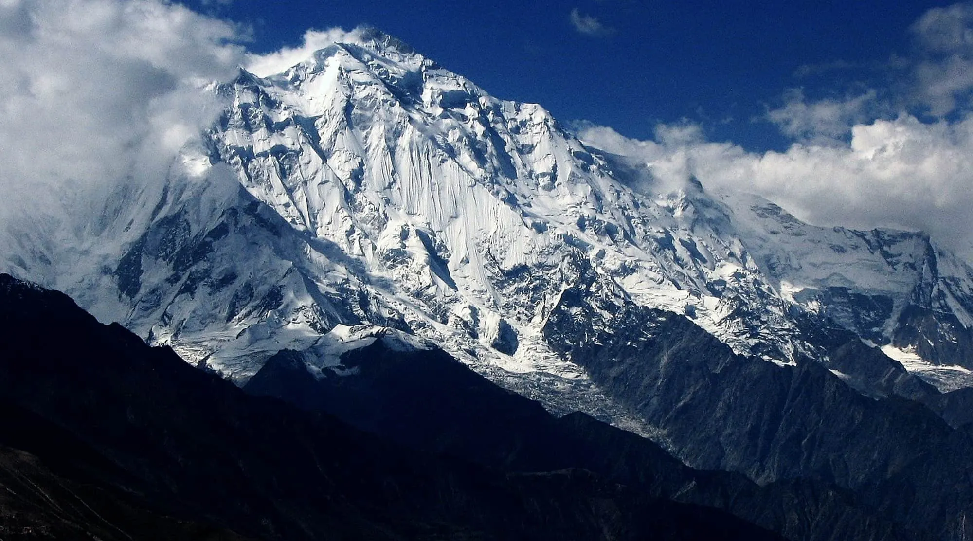
A five-day trip from Islamabad up the Karakoram Highway to Fairy Meadows, with one steady uphill walk and close views of the Raikot face of Nanga Parbat.
Per person in USD, full-board — the larger your group, the lower the per-person cost. We confirm your exact all-in figure in writing before any deposit.
| Group size | Per person |
|---|---|
| 7–10 people | $750 |
| 4–6 people | $900 |
| 1–3 people | $1,100 |
Excludes international flights, Pakistan visa, insurance, personal equipment and tips.
Guaranteed small-group dates for the 2027 season. Prefer your own dates? Every trip can also run privately inside its season window.
| 10 May 2027 → 14 May 2027 | Book this date |
|---|---|
| 10 Jun 2027 → 14 Jun 2027 | Book this date |
| 8 Jul 2027 → 12 Jul 2027 | Book this date |
| 5 Aug 2027 → 9 Aug 2027 | Book this date |
| 5 Sept 2027 → 9 Sept 2027 | Book this date |
| 1 Oct 2027 → 5 Oct 2027 | Book this date |
This five-day trip takes you from Islamabad up the Karakoram Highway to Fairy Meadows, a grassy plateau at about 3,300 m facing the Raikot face of Nanga Parbat. It suits reasonably fit first-time trekkers who want a close view of a major Himalayan peak, with one real uphill walk and no long expedition.
The first and last days are long drives on the Karakoram Highway, through the Hazara hills and along the Indus gorge in Kohistan. Chilas, the main town of Diamer in Gilgit-Baltistan, is the overnight stop on the way in and out. At the Raikot Bridge, near Chilas, a famously narrow jeep track leaves the highway and climbs to Tato village; from there the only way on is a 3–4 km uphill walk of roughly two to three hours to the meadow.
Beyond the meadow rises Nanga Parbat (8,126 m), the ninth-highest mountain in the world. The name means Naked Mountain, and it is nicknamed the Killer Mountain after the lives lost in early attempts to climb it; the first ascent came in 1953. Accommodation at the meadow is in simple wooden huts, electricity is limited and mobile signal is unreliable, so plan to be largely offline.
There is no technical climbing, and the full day at the meadow keeps the walking flexible. Beyal Camp, a high pasture and campsite reached through forest, is a half-day out and back; fitter walkers can continue towards the base-camp viewpoint at about 3,900 m, which fills a whole day. We grade the trip Moderate, at the gentler end: the climb from Tato is steady rather than technical, but 3,300 m is high enough to bring headaches or poor sleep to some people, so the pace stays slow.
The trip runs from April to October, when the track and the huts are open. Conditions change a good deal across that window, and in any month the mountain tends to be clearer in the early morning than in the afternoon.
5 stages over 5 days, starting and finishing in Islamabad. Routes can be shortened, extended or privately dated.
Leave Islamabad early and drive north into the Hazara hills, through Abbottabad and Mansehra, then follow the Indus from Thakot through Besham and Dasu. The road is narrow and slow in places, with occasional rockfall and roadworks, so this is a long day in the vehicle. Overnight in Chilas.
Drive from Chilas to the Raikot Bridge, where local jeeps take over for the climb to Tato village; the track is steep and unsurfaced, with drops at the edge, and not a comfortable ride for everyone. From Tato you walk the final 3–4 km uphill, roughly two to three hours, to Fairy Meadows at about 3,300 m. Porters can carry larger bags, and Nanga Parbat comes into view at the meadow, weather permitting.
A full day at Fairy Meadows with no packing. The usual outing is the forest walk to Beyal Camp, about half a day out and back; fitter walkers can carry on towards the base-camp viewpoint at about 3,900 m, which fills the day. We choose in the morning according to the weather and how everyone is feeling, and start early while the mountain is clear.
Walk down to Tato, which is quicker than the climb but hard on the knees, then take the jeeps back to the Raikot Bridge. Rejoin the Karakoram Highway and drive back along the Indus to Chilas for the night.
Leave early for the long drive out of the mountains, through Kohistan and Besham and down into the Hazara hills past Mansehra and Abbottabad. Much of the day is on the road and arrival depends on traffic and any landslide delays, so please leave a margin before an onward flight.
These are the standard inclusions for our trekking programmes and are confirmed in writing on your final itinerary before any payment is taken.
It is 3–4 km and takes about two to three hours, uphill almost all the way. There is no technical ground, but the path is steep in places and you finish at around 3,300 m, so reasonable everyday fitness helps. You can go at your own pace, and porters can carry larger bags.
It is narrow, steep and unsurfaced, with drops at the edge in places, and it is driven by local jeep drivers who know it well. Some travellers enjoy it and others find it uncomfortable, so tell us beforehand if heights bother you.
Yes, as an optional day hike from Fairy Meadows on Day 3, towards the viewpoint at about 3,900 m. It fills a whole day, so we decide in the morning according to the weather and how you are feeling; the walk to Beyal Camp is the shorter alternative.
Basic rather than comfortable: accommodation is in simple wooden huts, electricity is limited and mobile signal is unreliable. Nights at around 3,300 m are cold even in summer, so bring warm layers.
This is graded moderate. You should be comfortable walking for several hours a day, on rough ground, across 5 Days. Porters carry the main loads; you carry a light daypack. If you tell us your recent hill days we will give you an honest answer.
The reliable window is April – October. Outside that, conditions on the route make it either unsafe or not worth the money. We can run private departures on any dates inside that window.
2–14. Smaller and private groups are available and often cost less per head than you would expect — ask us for a quote on your own dates.
The headline is the per-person rate for a standard group of 7–10; smaller groups pay a little more per head because fixed costs — guide, permits, liaison officer and transport — are shared across fewer people. Prices are full-board, and we confirm your exact all-in total in writing before any deposit.
No reviews yet — be the first to review the fairy meadows short trek.
Practical guides to help you prepare for the fairy meadows short trek: